Wilson County News
By Amy Seiford, WCN Correspondent
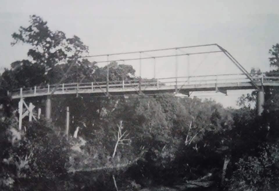
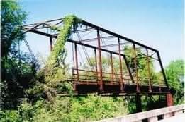
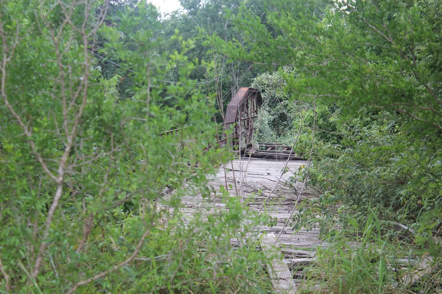
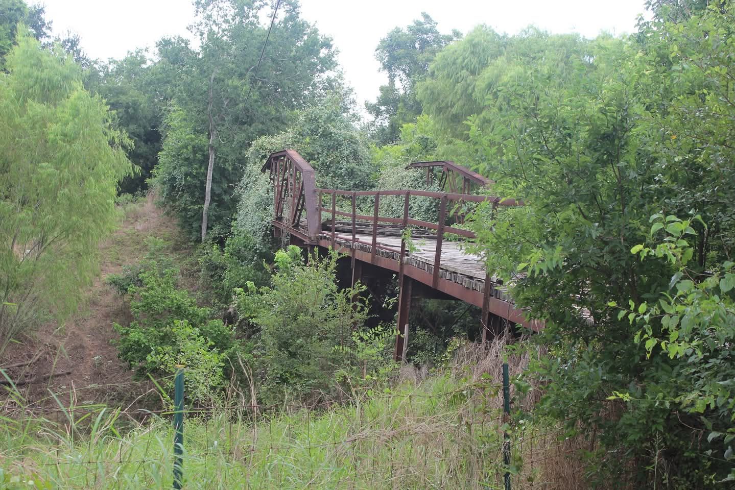
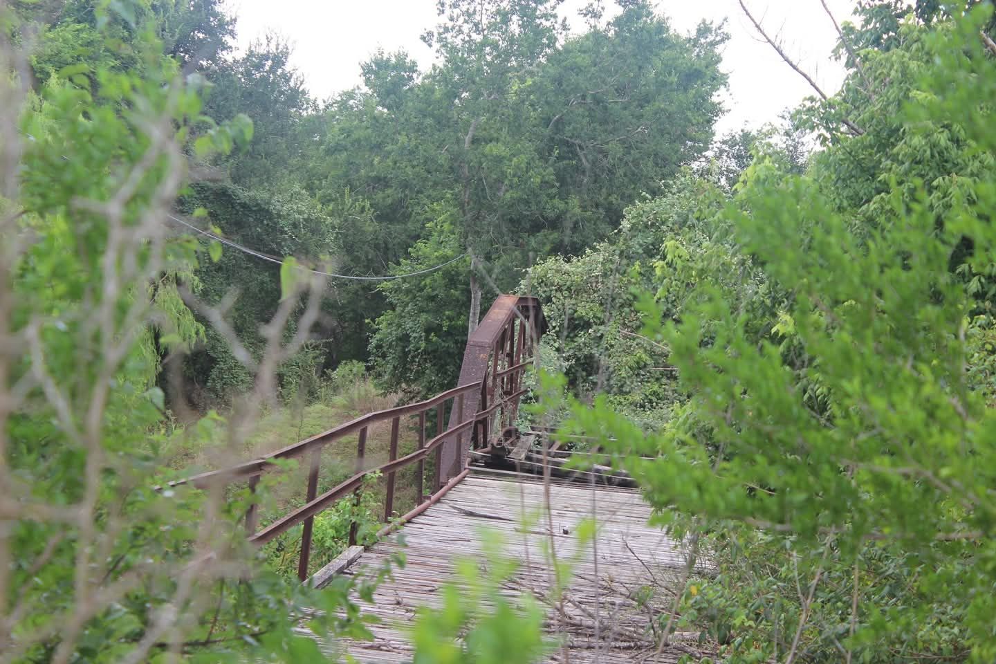
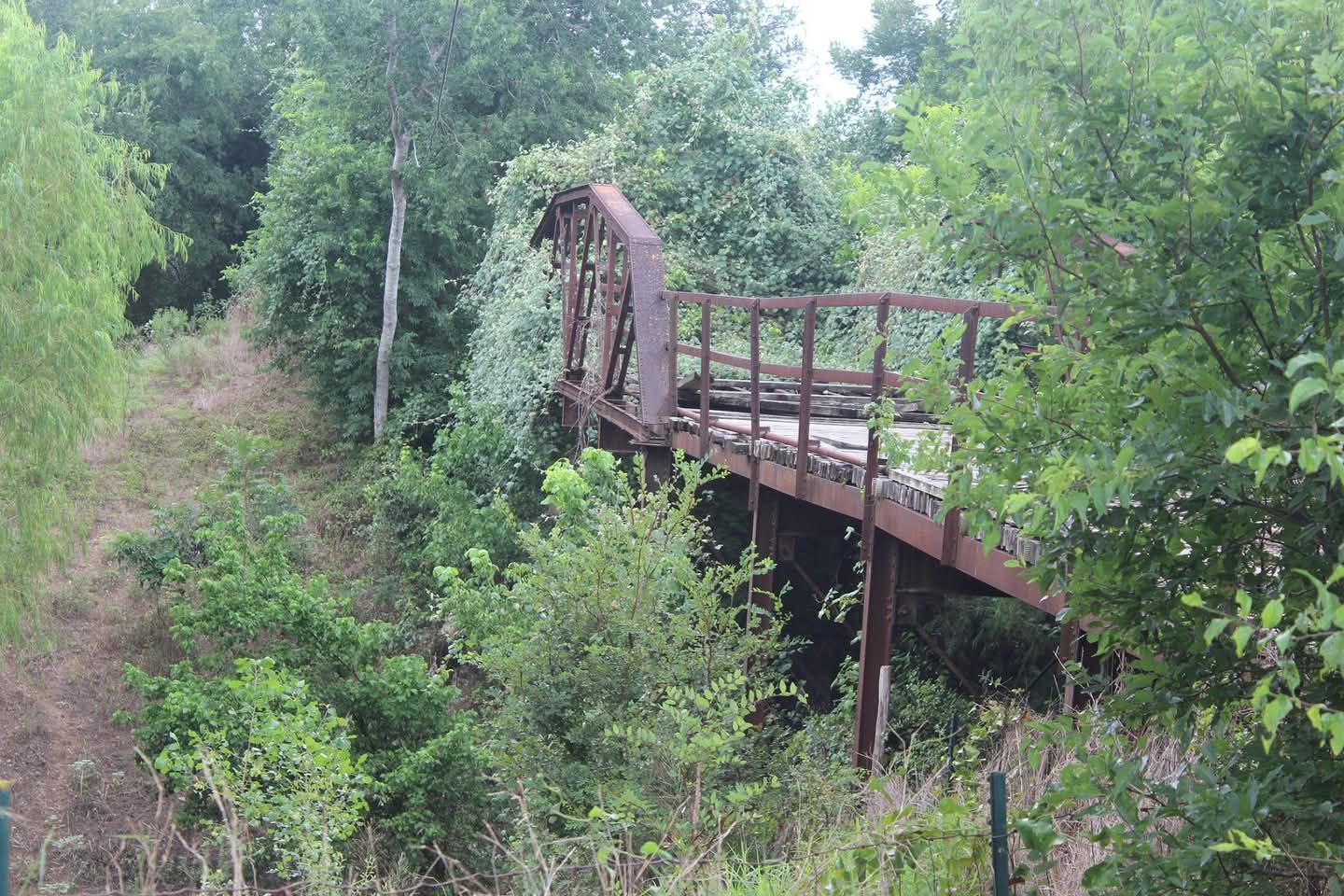
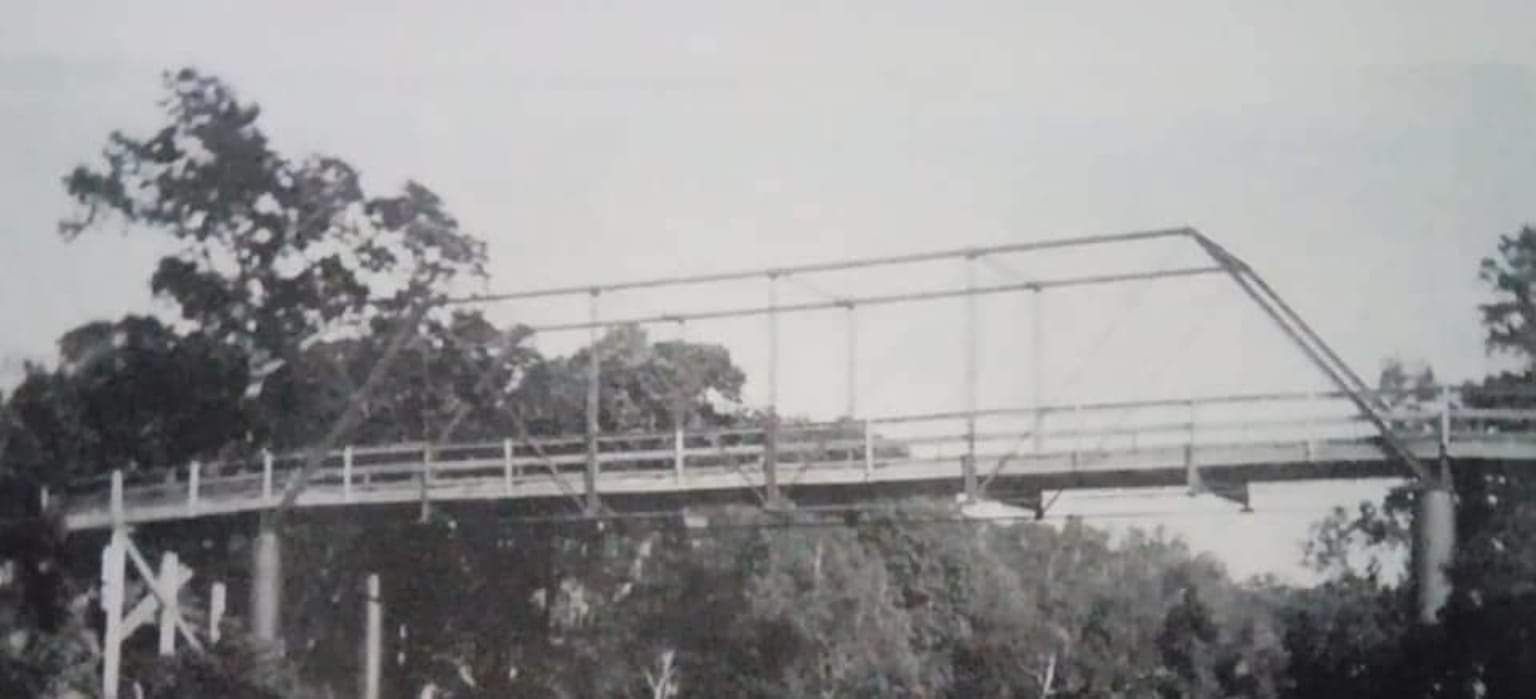
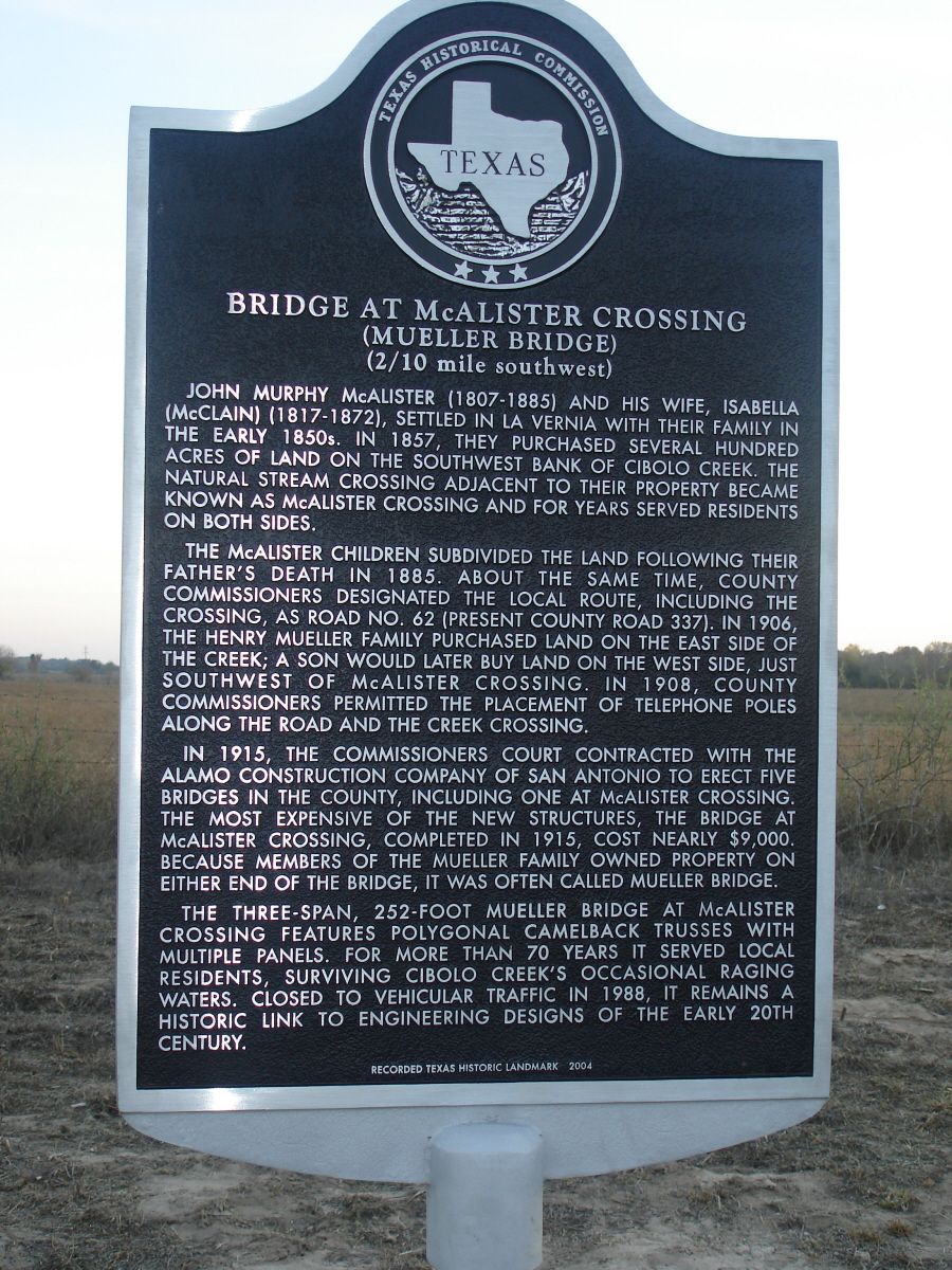
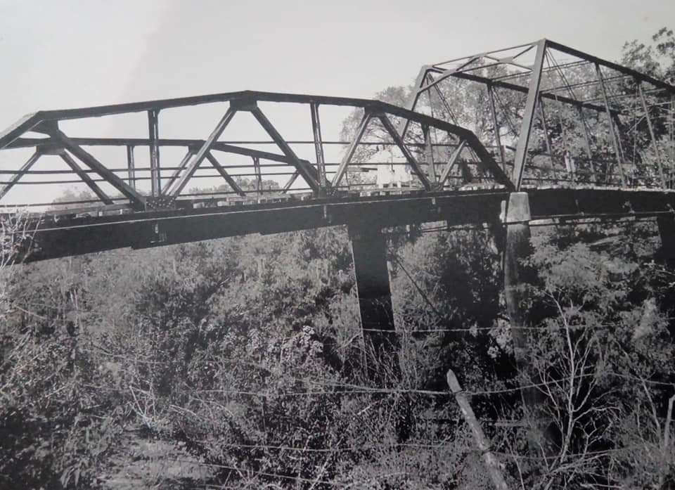
While the Bridge at McAlister Crossing, also known as Mueller Bridge, has always had a special place in the hearts of local residents, now it will also have a permanent place in history.
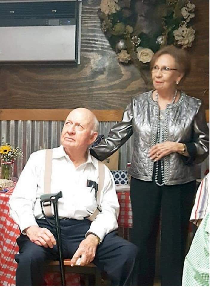
The bridge, which is located on C.R. 337, has been designated as a "Recorded Texas Historic Landmark" largely as part of the efforts of La Vernia residents John and Shirley Grammer and the Wilson County Historical Society.
"Wilson County has not received a 'Recorded Texas Historic Landmark' designation since the Polley Home and Brahan Masonic Lodge in 1965 and the Wilson County Courthouse in 1984," said Gene Maeckel, chairman of the Wilson County Historical Society.
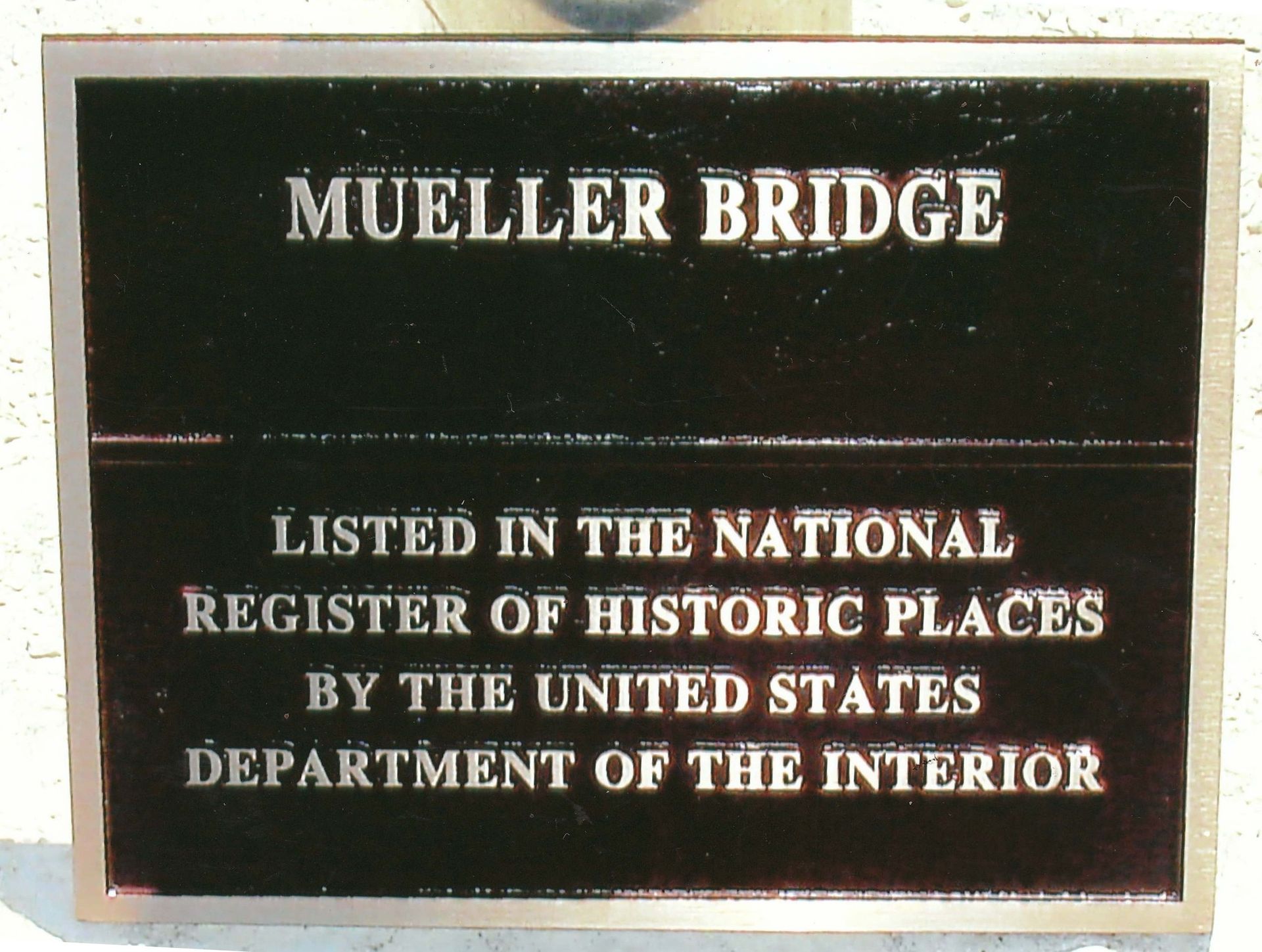
The Grammers have been involved in working toward a marker for the bridge since 1996, when Maeckel received a letter from the Texas Department of Transportation informing the society and the county the old bridge on C.R. 337 was eligible for listing in the "National Register of Historic Places."
Maeckel forwarded the letter to the Grammers and suggested they research the bridge and try to get a marker and possibly save the bridge, since it was an example of early bridge design in the area.
"TxDOT thought the county might want to build a new bridge there," Shirley said. "They hated to see the bridge torn down because it had historical value."
In a letter to TxDOT, Maeckel told the agency that the members of the historical society overwhelmingly felt the bridge structure should not be removed.
"This bridge has local significance and is worthy of preservation," Maeckel said. "And there is strong local interest in saving the structure. This part of Wilson County has a rich historical past."
And because of that rich history, the Grammers went to work on getting the bridge designated as a historical marker, although the couple had a hard time finding out information about the bridge's namesakes, John Murphy and Isabella McAlister, who settled in La Vernia with their family in the early 1850s.
"We had to do a lot of research to get information on the McAlister family — there was very little documented," Shirley said. "They played a very important role in the development of Wilson County and John McAlister was an early county official."
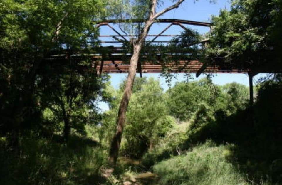
In 1857, the McAlisters purchased several hundred acres of land on the southwest bank of the Cibolo Creek. The natural stream crossing adjacent to their property became known as McAlister Crossing and served residents on both sides for many years.
The McAlister children subdivided the land following their father's death in 1885. About the same time, county commissioners designated the local route, including the crossing, as Road No. 62, which is presently C.R. 337.
In 1906, the Henry Mueller family purchased land on the east side of the creek, and a son later purchased land on the west side, just south of McAlister Crossing.
As settlers began to arrive and settle on both sides of the Cibolo, it became apparent to the settlers on the east side of the Cibolo that a shorter route to La Vernia and access to the railroad was needed. Settlers on the west side of the Cibolo needed a more convenient route to the Sutherland Springs-Seguin Road.
An old Indian crossing on the Cibolo on the McAlister property thus became known as "McAlister Crossing," and was used until a bridge was constructed. Due to the depth and steep embankments of Cibolo Creek, natural crossings were few.
According to the Grammers, McAlister Crossing provided a vital link between the old Sutherland Springs-Seguin Road, now F.M. 539, and the old Chihuahua Road, now C.R. 342.
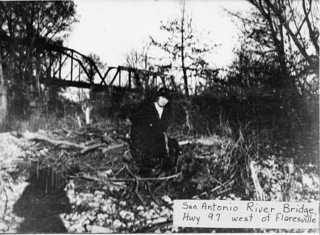
According to historical documents, on May 14, 1915, the county commissioners approved construction of five bridges during the meeting, including the "Bridge at McAlister Crossing." The title was later shortened to Mueller Bridge, since many of the Mueller family members owned property on both ends of the bridge.
The commissioners concluded it was necessary for the bridges to be erected for the good of Wilson County and for the safety and convenience of the public.
The contract was awarded to Alamo Construction Co. in San Antonio at a cost of $8,500.
In order to provide funds for the payment of the bridge debt, the county commissioners ordered a county road-and-bridge tax of 15 cents per $100 valuation of all taxable property in the county, according to meeting minutes from the commissioners' court.
Fritz Mueller, son of Henry Mueller, owned a blacksmith shop on F.M. 539 on a portion of the original Henry Mueller survey, which was located on the east side of the old Mueller Bridge. Walter Mueller, son of Fritz who lives in San Antonio, said that Fritz made the nuts and bolts in his blacksmith shop that were used in construction of the bridge.
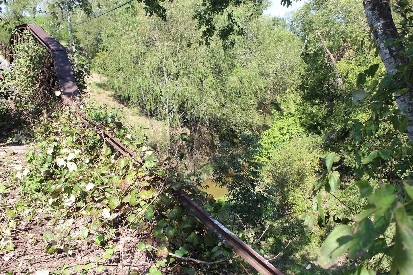
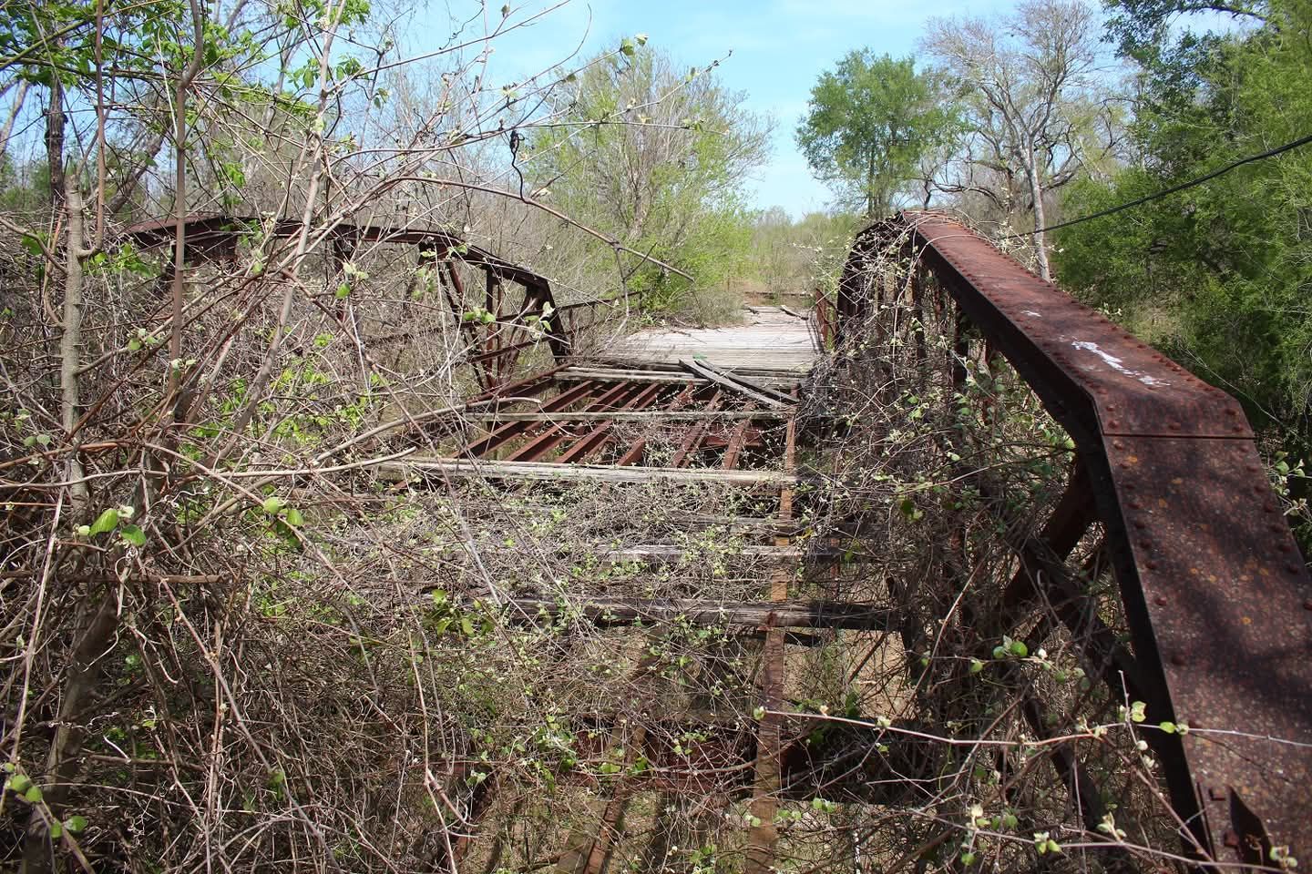
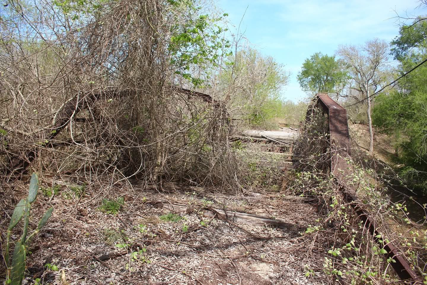
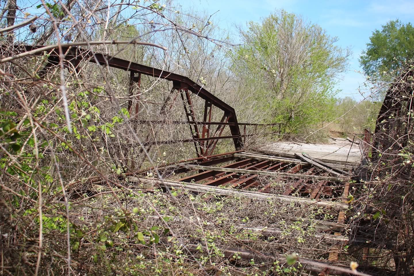
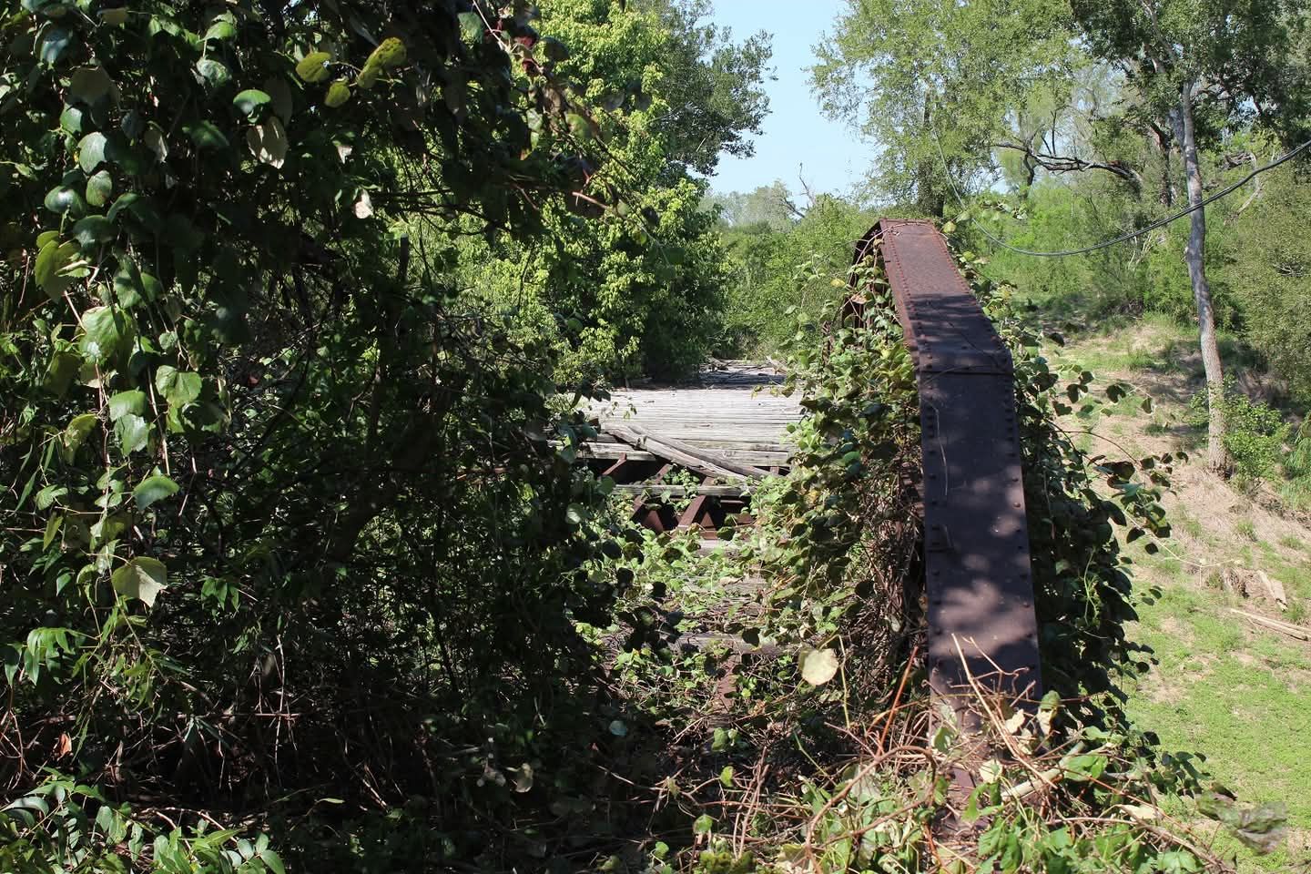
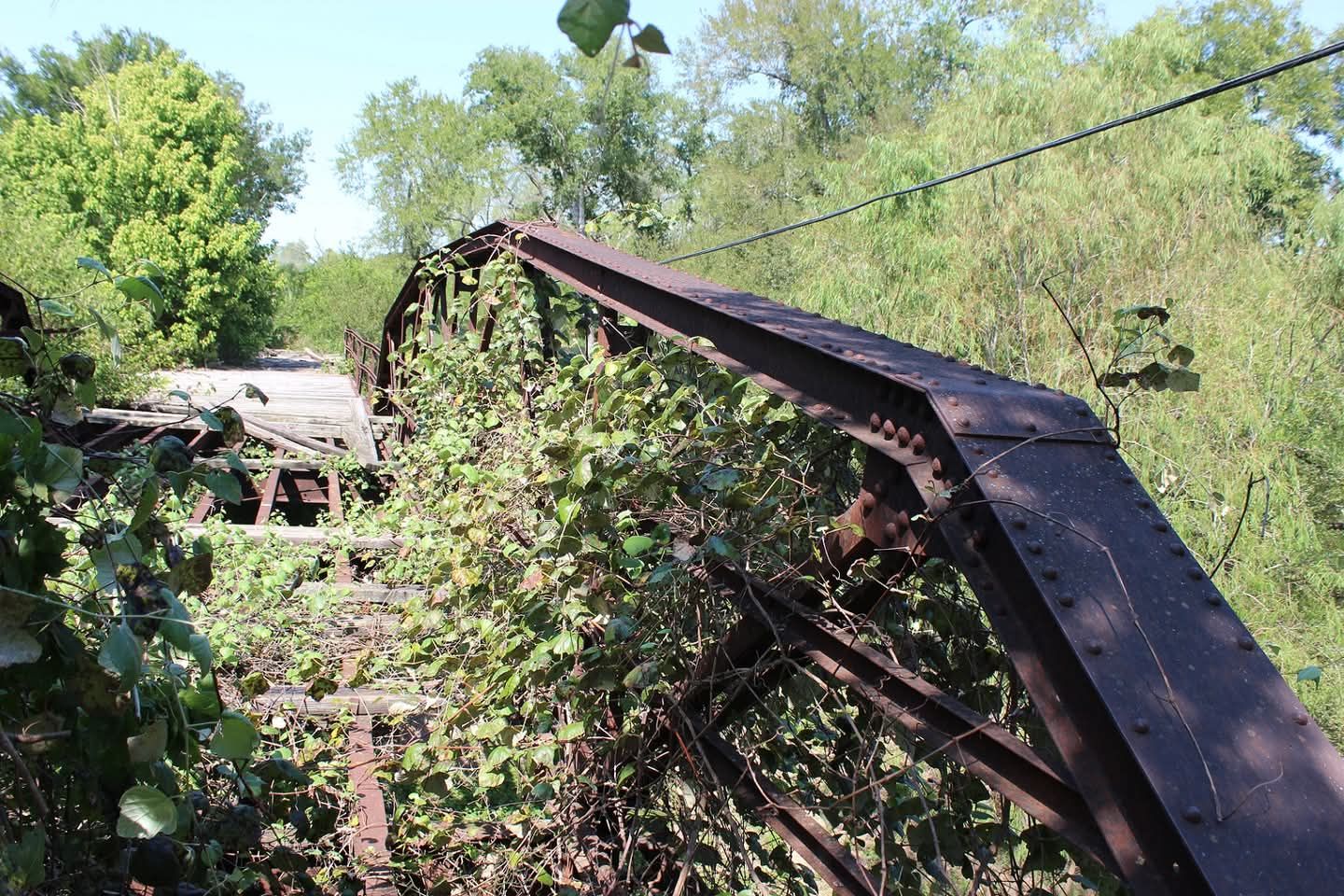
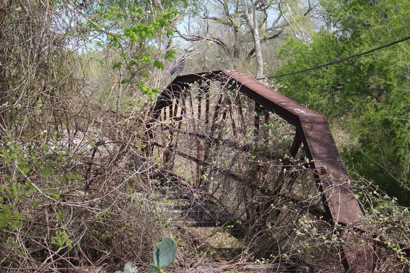
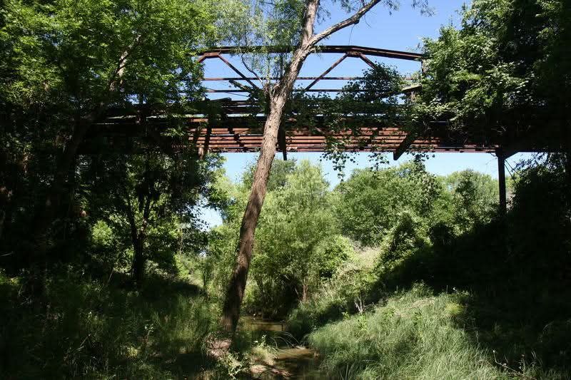
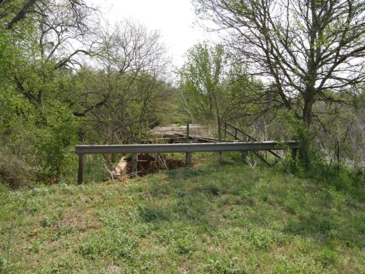
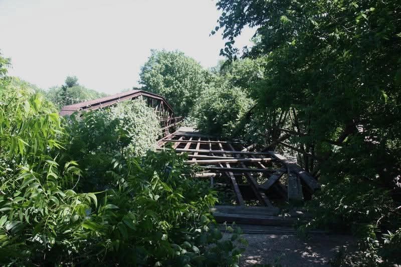
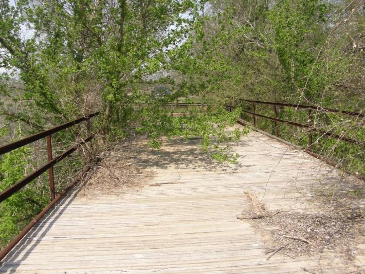
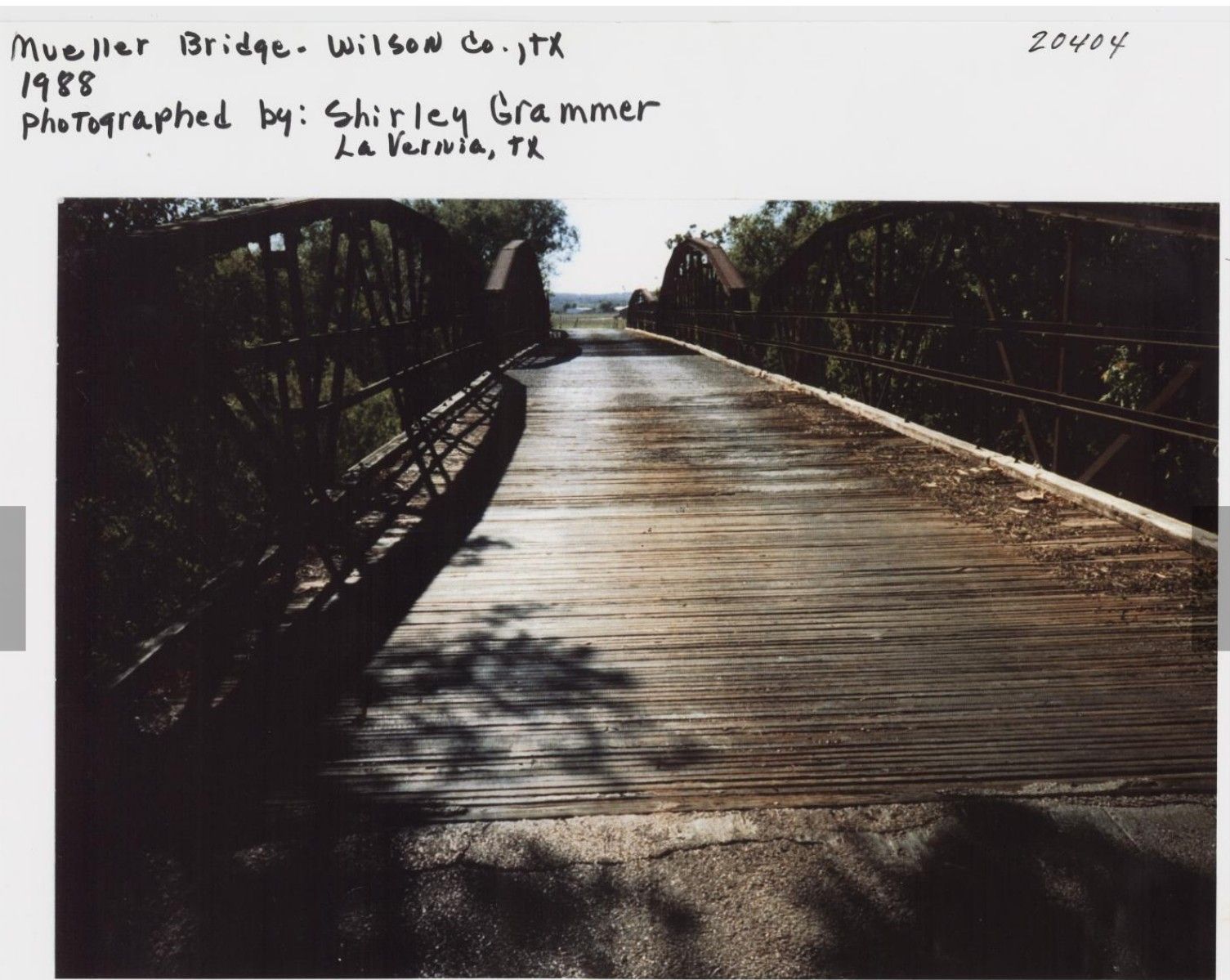
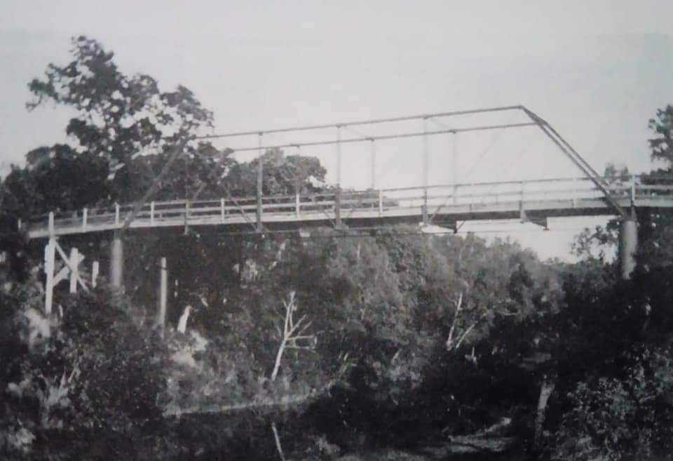
The bridge was officially completed on Nov. 8, 1915. The three-span, 252-foot bridge was special because it was only one of two multi-span Warren polygonal chord bridges in the state.
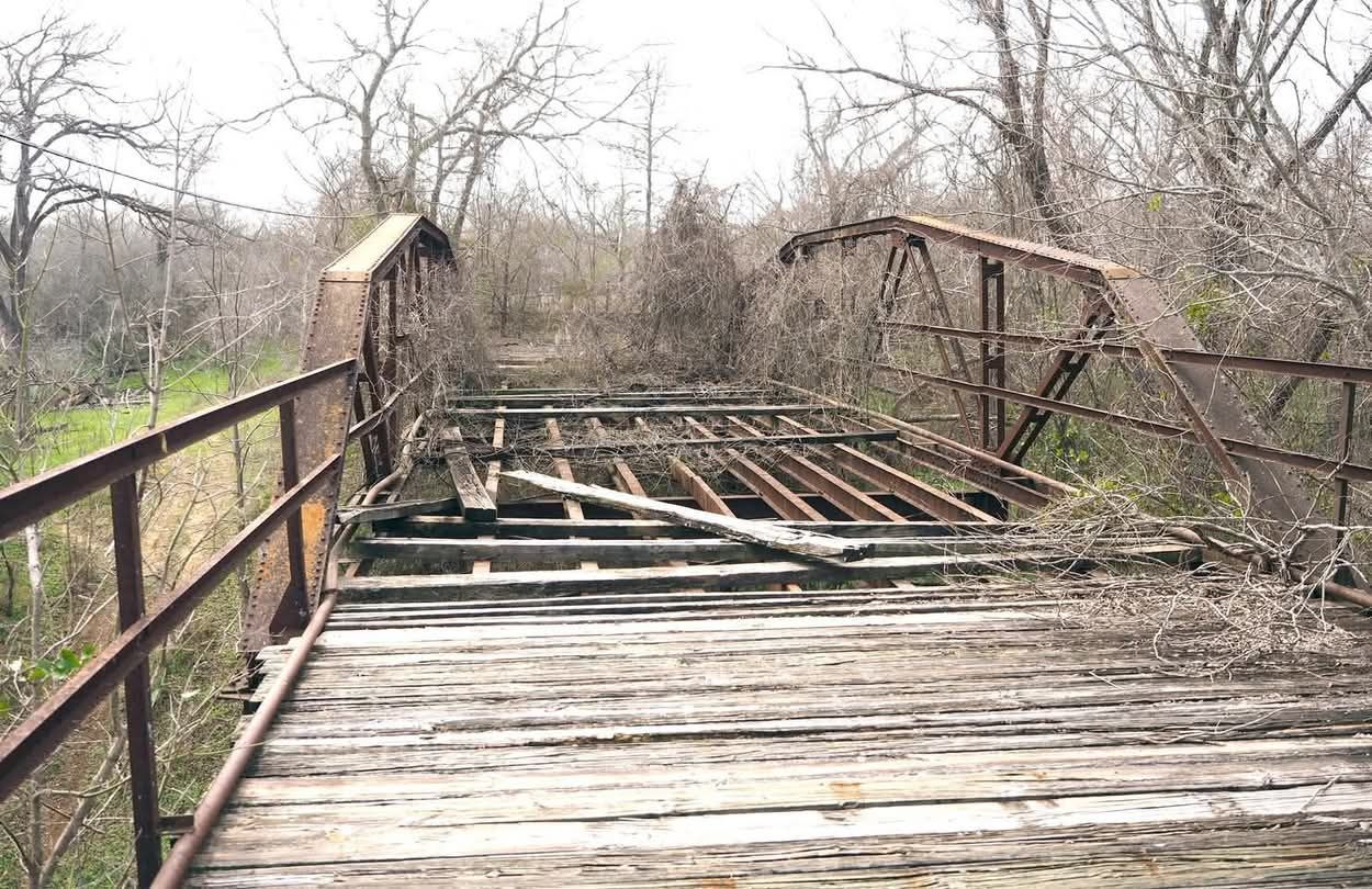
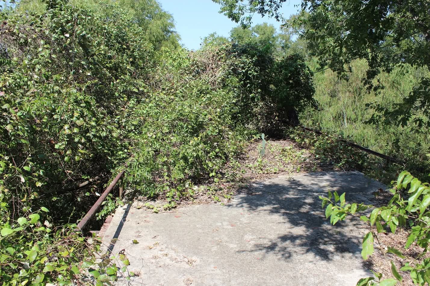
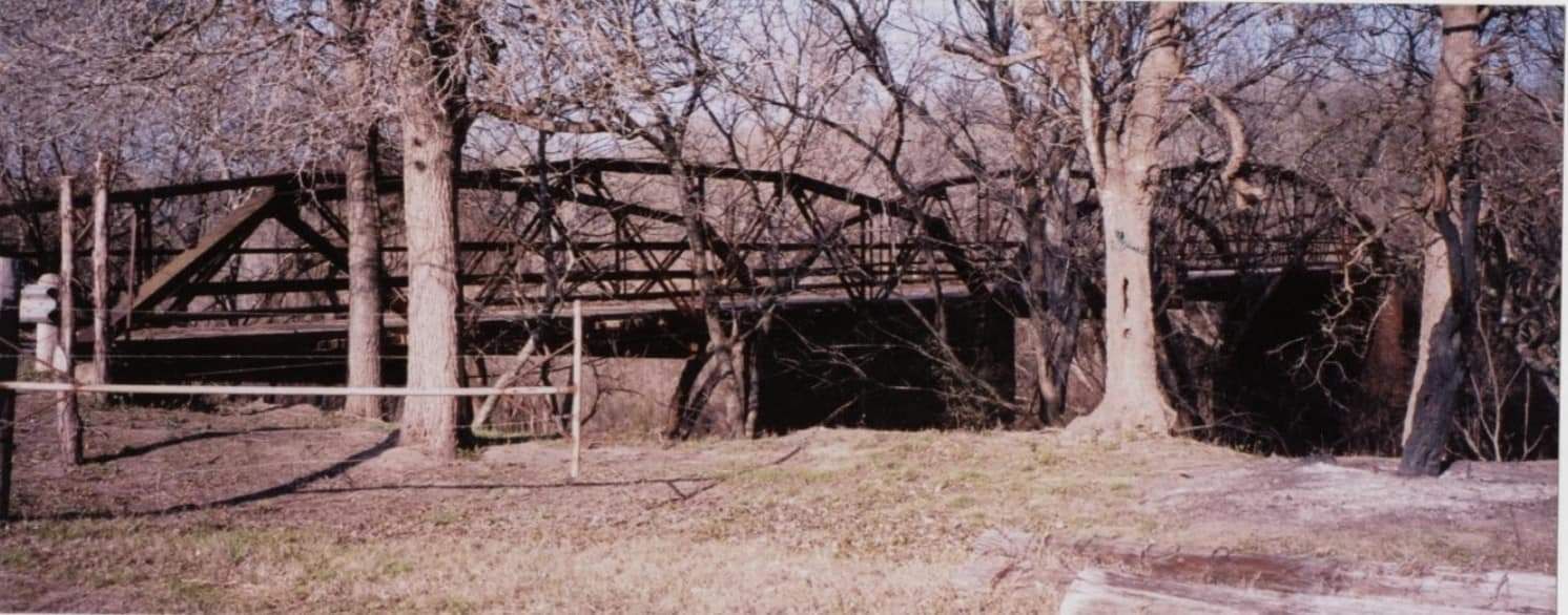
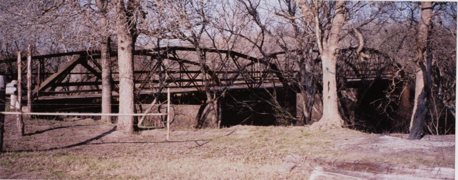
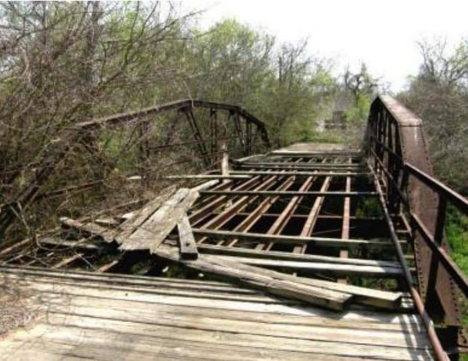
The bridge served local residents for more than 70 years. It was closed to traffic in 1988.
Over the years, floods have taken a toll on the bridge, especially the floods of 1973 and 1998, which caused serious damage to the support structure.
The Grammers said the project is rewarding now that it is complete. Now the focus is on saving the old bridge.
"It's such a pretty bridge and all we have left in the La Vernia area," Shirley said. "Historic bridges are hard to find because counties usually tear them down to build newer bridges."
The Grammers would like to see the bridge saved and the addition of a hike-and-bike trail, where people could ride across the bridge and the Cibolo that runs underneath it.
"It could be a beautiful tourist site for Wilson County," Shirley said.
*************
(John and Shirley Grammer are highly respected throughout Wilson County Texas as their faithful aspiration to preserve Wilson County history in places, cemeteries, bridges, buildings, & more. )